Projects, Sorted by Type
Scenario Plans
Foodscapes introduces urban food gardens on the Fayetteville Public Library campus in the downtown core.
The goal of this study is to envision a Livability Improvement Plan for Willow Heights that triangulates economic feasibility with enhanced placemaking and building renovations to create a blended-income neighborhood.
The scenario plan envisions the foodshed as an ecological municipal utility, featuring green infrastructure, public growscapes, and urban spaces related to food processing, distribution, and consumption.
What if 80% of future growth occurred around a new streetcar system along Fayetteville’s main commercial arterial, presently dominated by sprawl and the automobile?
This regional rail study is the first step in helping Northwest Arkansas envision smart growth development opportunities through context-responsive transportation planning.
Town and City Plans
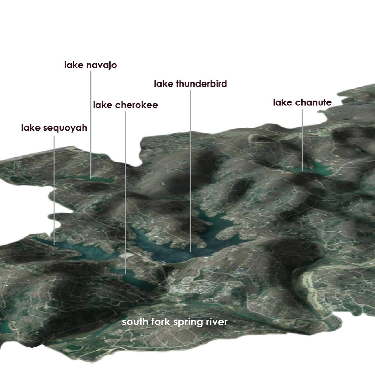
The Framework Plan aims to direct growth in population, housing, and tourism that amplify Cherokee Village’s nature, ecosystems, sense of place, and heritage.
Imagine downtown Pine Bluff, the regional neighborhood of choice for mixed-income households seeking the option of an urban lifestyle where they can walk or bike safely to work, school, church, shops, and lakeside recreation . . . and it’s affordable!
The city and the watershed are distinct systems of flow that generate shape and structure across the landscape to maximize their intrinsic objectives. How can city form fix the watershed?
The lamination of a slow street with a highway stretches the civic landscapes and pedestrian spaces common to a town square along Mayflower's 4,500-foot length.
This disaster recovery plan responds to the community's desire for small town urbanism, local commerce, and community saferooms after a tornado destroyed much of the town in 2014.
The scenario plan envisions the foodshed as an ecological municipal utility, featuring green infrastructure, public growscapes, and urban spaces related to food processing, distribution, and consumption.
A suburban five-lane commercial arterial is transformed into a multiway boulevard including public art and edible landscaping.
Without land-use zoning, the challenge is to devise alternative plans and form-based codes for a town without the capacity to progressively shape its growth.
Park Plans
The botanical garden and zipline for Cherokee Village, a rural mid-century planned community in the Ozarks, is the center piece of new hospitality/eco-tourism landscapes under development.
Through the use of townscaping elements, the design creates a new urban living room for a downtown on the cusp of regeneration.
The environmental education center is conceived as an exhibit landscape that curates visitors’ passage through unique ecological facilities, landscapes, and architectural structures.
This project is an ecotone improvement for the West Side Wastewater Treatment Plant and adjacent Woolsey Wet Prairie Sanctuary, a heritage Ozark preserve.
Flyover gardens are a new hybrid that integrates highway infrastructure and landscape while restoring the urban surface for pedestrian market activity.
Instead of new construction, the proposal unearths 13th century cellars and utilizes incremental developments to reunite disjointed functions within the square.
The revitalization plan begins with selective aggregations of affordable housing ($100K units) around two neighborhood parks: one existing and one proposed.
This habitat restoration and education garden for the Paul Nolan Wastewater Treatment Plant and adjacent prairie restores ecological and recreational functions.
This proposal for a South Beach Museum design competition celebrates beachheading in multiple ways: politically, ecologically, urbanistically, and socially.
Like waterfronts and transit stops, parks leverage value in urban areas. The park is envisioned as the anchor for a larger urban landscape network.
Identifiable arboreal spatial arrangements like allées, bosques, hammocks, and groves form outdoor rooms to create a living educational center at Little Rock's Two Rivers Park.
Distinguished by their contexts and fluvial profiles, three urban stream reaches are developed to create a new downtown greenway.
Neighborhood Plans
The pocket neighborhood is a new real estate product for middle America substituting shared neighborhood greens for front yards and car parking in garages at the front of the house.
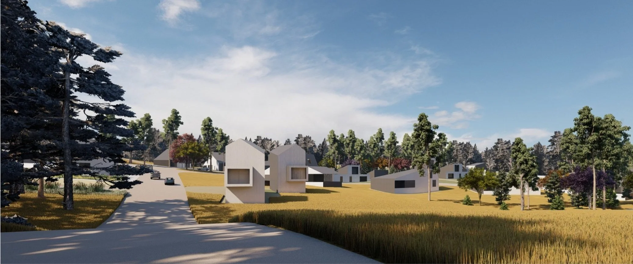
A Rural Timberlands Neighborhood proposed for southwest Arkansas employs resilient design to mitigate social and ecosystem disturbance regimes (housing deficiencies, wildfire, and erosion) structuring its context.
Double-front is an infill housing prototype that begins with a stacked duplex to create a range of missing middle housing configurations for small downtowns like Fayetteville, Arkansas (population: 85,000).
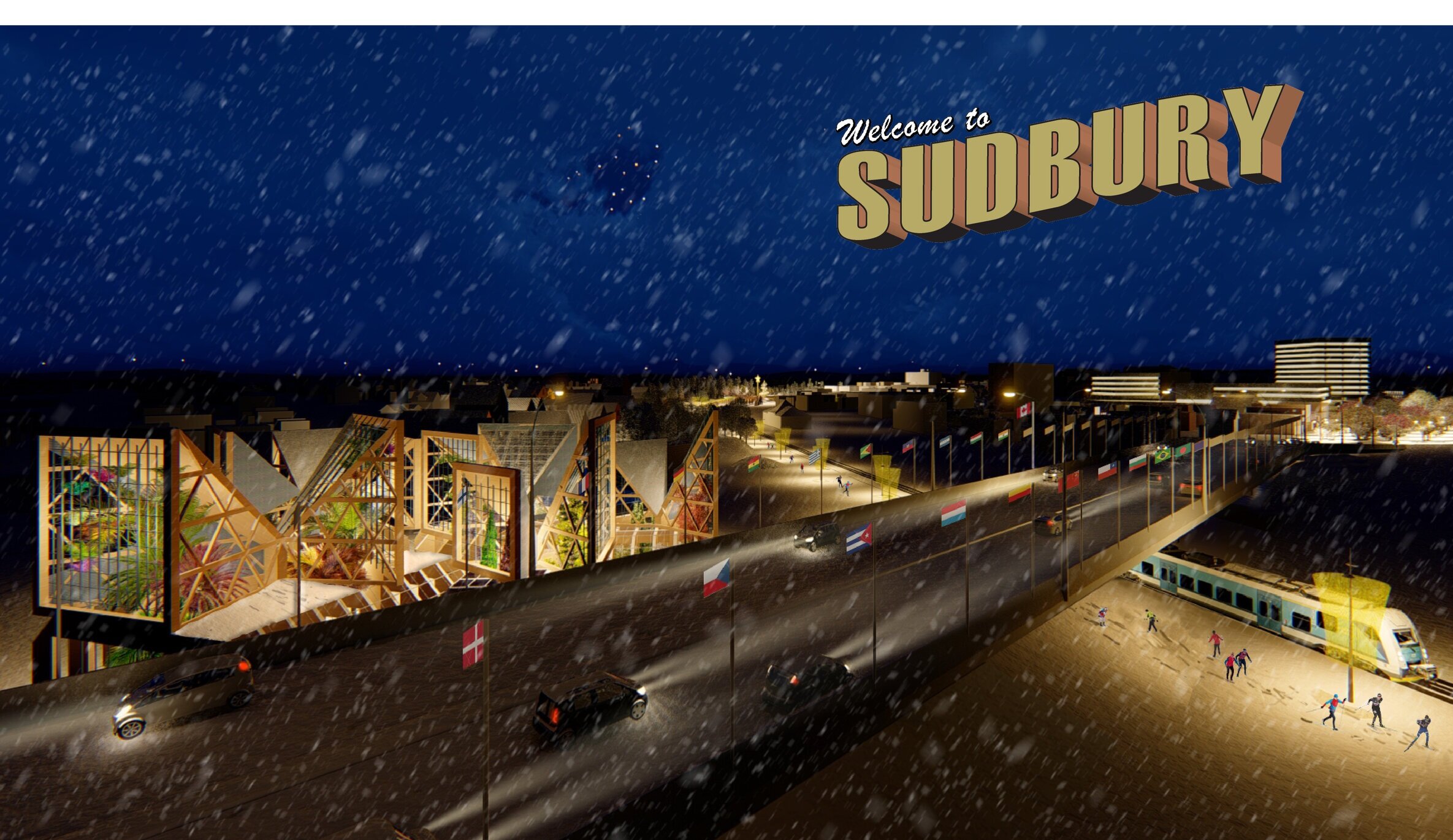
Sudbury’s industrial-era infrastructure—its rails, roads, and historic downtown are the basis for building 21st century low-carbon neighborhoods featuring new urban landscapes.
The lamination of a slow street with a highway stretches the civic landscapes and pedestrian spaces common to a town square along Mayflower's 4,500-foot length.
This disaster recovery plan responds to the community's desire for small town urbanism, local commerce, and community saferooms after a tornado destroyed much of the town in 2014.
This plan for a legacy downtown neighborhood recovers the full spectrum of land uses to meet the daily needs of its residents at all income levels with varying mobility needs.
The proposal reflects the green development philosophy outlined in The Rwanda National Strategy on Climate Change and Low Carbon Development.
A pocket neighborhood is an identifiable cluster of houses around shared outdoor commons and infrastructure.
A suburban five-lane commercial arterial is transformed into a multiway boulevard including public art and edible landscaping.
The revitalization plan begins with selective aggregations of affordable housing ($100K units) around two neighborhood parks: one existing and one proposed.
Planning leverages urban and ecological services in the porch, yard, street, and open space. Neighborhoods are developed as sub-watersheds.
Like waterfronts and transit stops, parks leverage value in urban areas. The park is envisioned as the anchor for a larger urban landscape network.
The Habitat for Humanity neighborhood is designed as a sponge to work in accord with existing hydrological drainage, catchment, and recharge patterns.
The housing master plan shifts age related planning processes from traditional institutional settings toward a more community-based solution.
Streetscapes
Sudbury’s industrial-era infrastructure—its rails, roads, and historic downtown are the basis for building 21st century low-carbon neighborhoods featuring new urban landscapes.
A former scrap metal yard located four blocks north of Conway’s main commercial street was re-imagined as a new square surrounded by a mixed-use residential district.
The Maple Street Retrofit is articulated through a sequence of spaces including a grand urban room at the campus gates anchoring a landscaped cycle track and pedestrian walk.
The lamination of a slow street with a highway stretches the civic landscapes and pedestrian spaces common to a town square along Mayflower's 4,500-foot length.
The proposed School Avenue streetscape frames new development between the Walton Arts Center and the Fayetteville Public Library with arts-based civic infrastructure.
Beyond simple infill development, housing serves as a place-making tool to anchor a nascent downtown arts district for Fayetteville, Arkansas.
The Creative Corridor retrofits a four-block segment of an endangered historic downtown Main Street through development catalyzed by the cultural arts rather than Main Street’s traditional retail base.
What if 80% of future growth occurred around a new streetcar system along Fayetteville’s main commercial arterial, presently dominated by sprawl and the automobile?
Flyover gardens are a new hybrid that integrates highway infrastructure and landscape while restoring the urban surface for pedestrian market activity.
A suburban five-lane commercial arterial is transformed into a multiway boulevard including public art and edible landscaping.
Like waterfronts and transit stops, parks leverage value in urban areas. The park is envisioned as the anchor for a larger urban landscape network.
Highway Ecologies is a participatory planning model to achieve context-sensitive highway design.
Campus Plans
Three holistic solutions remediate a 2,000-foot urban stream corridor running through the Fayetteville campus of the University of Arkansas.
Housing
Adult Family Homes (AFHs) are small-scale, residential care settings that provide non-medical, long-term support for seniors and adults with disabilities who need help with daily living but do not require institutional care.
Housing-neighborhood complexes are multifamily derivatives of single-family housing that incorporate communal space.
GrowLofts share food, energy, and conviviality at its edges without sacrificing household autonomy.
A Rural Timberlands Neighborhood proposed for southwest Arkansas employs resilient design to mitigate social and ecosystem disturbance regimes (housing deficiencies, wildfire, and erosion) structuring its context.
Double-front is an infill housing prototype that begins with a stacked duplex to create a range of missing middle housing configurations for small downtowns like Fayetteville, Arkansas (population: 85,000).
A former scrap metal yard located four blocks north of Conway’s main commercial street was re-imagined as a new square surrounded by a mixed-use residential district.
The Circle is a mixed-use live-work destination in a small town (Bentonville, Arkansas population: 40,000) undergoing urban succession from low-density metropolitan sprawl to a mature city with density and good town form.
Imagine downtown Pine Bluff, the regional neighborhood of choice for mixed-income households seeking the option of an urban lifestyle where they can walk or bike safely to work, school, church, shops, and lakeside recreation . . . and it’s affordable!
The goal of this study is to envision a Livability Improvement Plan for Willow Heights that triangulates economic feasibility with enhanced placemaking and building renovations to create a blended-income neighborhood.
Beyond simple infill development, housing serves as a place-making tool to anchor a nascent downtown arts district for Fayetteville, Arkansas.
The proposal reflects the green development philosophy outlined in The Rwanda National Strategy on Climate Change and Low Carbon Development.
A pocket neighborhood is an identifiable cluster of houses around shared outdoor commons and infrastructure.
Planning leverages urban and ecological services in the porch, yard, street, and open space. Neighborhoods are developed as sub-watersheds.
Like waterfronts and transit stops, parks leverage value in urban areas. The park is envisioned as the anchor for a larger urban landscape network.
The Habitat for Humanity neighborhood is designed as a sponge to work in accord with existing hydrological drainage, catchment, and recharge patterns.
The project addresses the departure of artists from Fayetteville with below market-rate housing for those who could not otherwise afford to live in the downtown.
The housing master plan shifts age related planning processes from traditional institutional settings toward a more community-based solution.
Studies (Investigative, Typological, etc)
Rather than simply see the porch as an element superadded to a house, it is more useful to consider its liminality and mutability in grasping the porch’s true transformative agency. A “floating signifier” that absorbs more meaning than it emits, the porch intertwined new combinations of home and economy, not unlike the American urban grid.
Cultural mappings describes the interconnectedness of landscapes, histories, and social geographies of the Arkansas Ozarks surrounding one of America’s first planned retirement‐based recreational communities.
The city and the watershed are distinct systems of flow that generate shape and structure across the landscape to maximize their intrinsic objectives. How can city form fix the watershed?
This manual is designed for those involved in urban property development, from homeowners, to institutions, developers, designers, cities, and regional authorities.
Planning leverages urban and ecological services in the porch, yard, street, and open space. Neighborhoods are developed as sub-watersheds.
This study is a rediscovery of place-making fabrics throughout Arkansas enjoyed intuitively by most people rather than interpreted syntactically.
This regional rail study is the first step in helping Northwest Arkansas envision smart growth development opportunities through context-responsive transportation planning.
This porch study explores a taxonomy of house porches, which for the most part lack an architectural pedigree.
This investigation designs the interface between the public realm and the algorithms by which the discount retail industry has become a dominant economic force.
Highway Ecologies is a participatory planning model to achieve context-sensitive highway design.
An emerging building type comprised solely of big box retail, the Vertical Power Center is unlike the suburban shopping mall and other shopping center types.


